
Week of 5 to 11 October 2026: showers after the cut-off low and the close of the hydrological year. What to measure and with what care
After an AEMET special warning for a cut-off low, the week stays unsettled across most of Spain and the 2025-2026 hydrological year closes 2% above normal, with sharp regional contrasts. Four official signals and what to check in your own record.
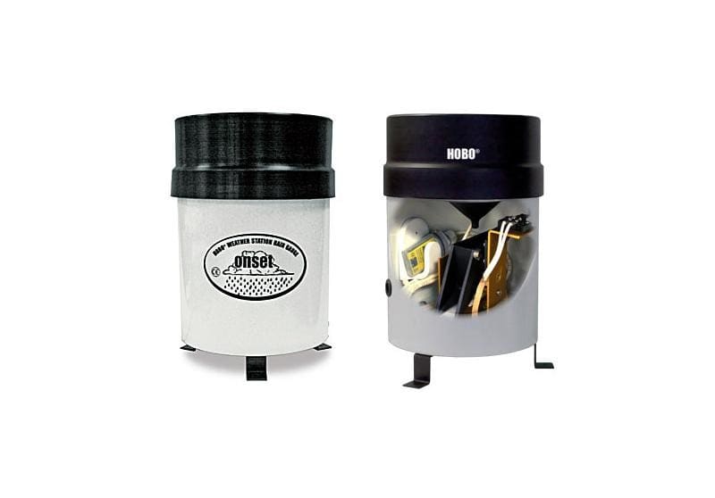
Checked: 5 October 2026, 06:45 Madrid time. The forecasts and warnings belong to the services cited and may have been updated.
After a weekend under a special warning for a cut-off low (a "dana", in Spanish forecasting), the question for anyone measuring rain is how much of what was recorded can be used as it stands. And on 30 September the hydrological year closed: time to total up your own.
Signals for the week
1. A cut-off low with very heavy showers and a Sunday with a warning of extreme totals. Special warning 34/2026 from AEMET, the Spanish State Meteorological Agency (Saturday 3 October, 14:32, valid until Sunday 4 October), named Sunday as the day of greatest impact, with very heavy or torrential precipitation in Barcelona and Girona and totals that could exceed 200 mm in 12 hours. For the start of this week, it expects the instability to persist: locally heavy showers in the centre on Monday and across the whole Peninsula on Tuesday, with forecast uncertainty that "is still very high". Source: AEMET, special warning 34/2026.
What to measure: before using the weekend total, go through the event interval by interval and compare the highest intensity with the datasheet. 200 mm in 12 hours is, on average, almost 17 mm per hour, and the peaks of a shower sit above the average. With what care: the accuracy of a tipping bucket is stated up to a given intensity; for the rain gauge in the commercial selection, ±1.0% up to 20 mm/h, with a maximum of 127 mm/h. Flag the intervals above that range, without deleting them or correcting them by eye; the reason is in our rain gauge guide. And do not go out to the field while a warning is active: AEMET asked people to take extreme care.
2. An unsettled week across most of Spain. For 5 to 12 October, AEMET expects unsettled weather to prevail in Spain, with rain and showers likely over most of the country, possibly heavier in the far north, mountain areas, the Mediterranean side of the Peninsula and the Balearic Islands. Source: AEMET, weekly forecast (02/10/2026).
What to measure: the rain at your own point, event by event; the special warning points to variations in space and time in where the precipitation maxima fall. With what care: if you fill a gap with data from another station, flag it and note the origin.
3. The hydrological year closes 2% above normal, but not everywhere. From 1 October 2025 to 29 September 2026, national mean precipitation in Spain was 652 mm, 2% above the normal value (638 mm). It is above the 1991-2020 average across much of the west and south of the Peninsula, locally above 150%, and below 100% in parts of the Cantabrian strip, the north-east and the south-east. Source: AEMET, summary of precipitation in Spain (01/10/2026).
What to measure: your own gauge's total from 1 October 2025 to 30 September 2026, with the days without data and any interventions on the equipment. With what care: 652 mm is a national mean; a year with gaps cannot be compared with a normal without saying how many days are missing.
4. Drought stable in Europe and on watch in central Iberia. The European Drought Observatory describes mid-September conditions as "stable yet critical across most of Europe", with new Watch conditions in the centre of the Iberian Peninsula and persistent ones in the north-east. The analysis dates from 29 September, using data from early in the month, and warns of known issues affecting the estimated soil moisture that may make the map less reliable in some regions, particularly western Russia. For mainland Portugal, according to IPMA, "O verão de 2026 foi o 3.º mais quente desde 1931" (summer 2026 was the third warmest since 1931). Source: European Commission Joint Research Centre, drought situation in Europe.
What to measure: rainfall and soil moisture at your point. With what care: the European map arrives weeks behind and the current one does not include this rain; when you cite it, give the date of the data.
Checklist
- Rain gauge: funnel clean, gauge level, record downloaded and out-of-range intervals flagged.
- Hydrological year 2025-2026: own total and days without data noted.
- Warnings: AEMET and IPMA.
Limits of this note
This is not an EIC Controls forecast: the forecasts and warnings are AEMET's and IPMA's, and the drought analysis is the European Drought Observatory's. The warning cited was the latest special warning published at the time of checking. If a warning is issued, follow the instructions of the met service and civil protection.
References
- AEMET (2026). Aviso especial de fenómenos adversos número 34/2026. Chubascos y tormentas muy fuertes y persistentes. Issued 03/10/2026 at 14:32 (accessed: 05/10/2026).
- AEMET (2026). Predicción para las semanas del 5 al 25 de octubre de 2026. Aemetblog, 02/10/2026 (accessed: 05/10/2026).
- AEMET (2026). Resumen de la evolución de las precipitaciones en España. Prepared 01/10/2026 (accessed: 05/10/2026).
- European Commission Joint Research Centre, European Drought Observatory (2026). Current drought situation in Europe. Analysis of 29/09/2026 (accessed: 05/10/2026).
- IPMA (2026). Verão de 2026 foi o 3º mais quente desde 1931. 30/09/2026 (accessed: 05/10/2026).
Commercial selection by EIC Controls
To know how hard it rained at your point, not just how much, the HOBO rain gauge with data logger is a 0.2 mm tipping-bucket gauge that stores the date and time of every tip. Its datasheet states an accuracy of ±1.0% up to 20 mm/h, a maximum rainfall rate of 127 mm/h and annual calibration, in the field or at the factory. Still to be defined are the installation point and how the data will be downloaded: the datasheet says a base station or shuttle is required.
Instruments for this application
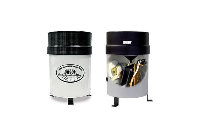
LI-COR (HOBO, InTemp, LI-COR) · RG3-M
HOBO Rain Gauge with Data Logger
The Data Logging Rain Gauge is a battery-powered rainfall data collection and recording system which includes a HOBO® Pendant Event data logger integrated into a tipping-bucket rain gauge. This model automatically records up to 3200 mm of rainfall data that…
Keep reading
Changing site or instrument without breaking the record: lessons from the Montseny summit series (1950-2025)
On 31 October 2026 AEMET and the SMC published an analysis of the Montseny summit series, which joins two sites and fills the gaps from 2001 to 2010. What it teaches anyone planning to move a station or change a sensor.
Week of 2 to 8 November 2026: possible frosts inland in the north and rain on the Mediterranean. What to measure and with what care
AEMET expects a week that will probably be warmer than normal in southern Spain, with possible night frosts inland in the north and the heaviest rain in the Mediterranean area and the Balearics. Four official signals, including the new regionalised seasonal forecasts, and what to measure with each.
The Commission proposes a common warming trajectory for climate risk assessments: what to measure at your site to read it
On 27 October 2026 the European Commission proposed the European Climate Resilience Law, with a reference global warming trajectory and periodic risk assessments. What that information describes, what it does not describe about your site and what is worth recording.