
Data logging · Weather monitoring
Sentinel-3C is in orbit: what a satellite measures and what your station still measures
On 15 September 2026 the European Union launched Copernicus Sentinel-3C. What it observes from 800 km, why land surface temperature is not air temperature, and what to log at your own point.
Anyone who maintains their own measurement point asks the same question whenever a new satellite is announced: does this replace what I have installed? The short answer is no, and it is worth understanding why.
What happened, and when
On 15 September 2026, at 03:21 CET, the European Union launched the Copernicus Sentinel-3C satellite from Europe's Spaceport in Kourou, French Guiana, aboard a Vega C launcher. First contact with the satellite was established at 04:33 CET, according to the statement published the same day by the European Commission. The satellite operates at about 800 km altitude.
The Commission is explicit about the current state of the mission: the satellite will now spend several months in commissioning and calibration before it begins delivering observations to users. It is in orbit, but it is not yet delivering operational data.
What it observes, and at what detail
Sentinel-3C joins Sentinel-3A and Sentinel-3B, in service since 2016, and extends the mission record into the 2030s. It carries four main instruments, with markedly different spatial resolutions (EU Space Support Office, 27 August 2026):
- OLCI, ocean and land colour: 21 spectral bands, resolution up to 300 m.
- SLSTR, sea and land surface temperature: nine bands, between 500 m and 1 km.
- SRAL, radar altimeter: about 300 m along track.
- MWR, microwave radiometer: about 20 km.
The Commission lists what the mission observes: sea surface temperature, sea level and ocean currents, coastal water quality, wildfires, droughts and vegetation health, land surface temperature and heatwaves, and polar ice.
Why this does not replace your series
Here is the point that matters for anyone measuring. SLSTR measures surface temperature: the radiometric temperature of whatever the sensor sees from above, whether asphalt, bare soil, vegetation cover or water. A ground station measures air temperature, usually a short distance above the ground and inside a radiation shield. These are not the same quantity, and the difference between them is not a fixed value.
A peer-reviewed study published on 3 April 2026 in the journal Sci quantifies this for a specific European case. Woollard, Gauci and Micallef compared land surface temperature from Landsat-8, MODIS and Sentinel-3A/3B with air temperature measured in situ at 19 sites in Malta, in monthly campaigns between September 2024 and February 2025, in the morning (09:00 to 13:00) and in the evening (20:00 to 23:30).
In the morning, the Sentinel-3 level 2 product showed a correlation of 0.82 and a bias of -1.89 °C against air temperature. At night, the correlation fell to 0.75 and the bias reached -6.89 °C; MODIS showed a comparable night-time bias of -6.91 °C. Applying an empirical correction of +6.86 °C to both sensors reduced the bias to values close to zero.
In other words: at that site, in those months and at those hours, the satellite product departed from air temperature by several degrees, and did so very differently by day and by night.
What to measure, then
If the aim is to compare or complement satellite data with your own point, three concrete decisions follow:
- Document the geometry of the point: sensor height, the radiation shield used, the ground cover around it and the distance at which that cover changes. The authors caution that a point measurement cannot fully represent the thermal characteristics of the satellite pixel, particularly with coarse-resolution sensors.
- Log at an interval short enough to hold values close to the satellite overpass time, and record the time in an explicit time reference.
- Do not import a correction factor from somewhere else. The bias measured in Malta belongs to Malta.
What is still unknown
The Commission has set no date for the end of commissioning: it refers to several months. Until that is complete there are no operational Sentinel-3C data and no independent assessments of how its SLSTR performs. The authors of the Malta study also state two explicit limits: the observed period does not include summer, which limits conclusions about extreme heat conditions, and the island and coastal setting introduces its own deviations through atmospheric water vapour, surface emissivity, viewing geometry and within-pixel heterogeneity.
Commercial selection by EIC Controls
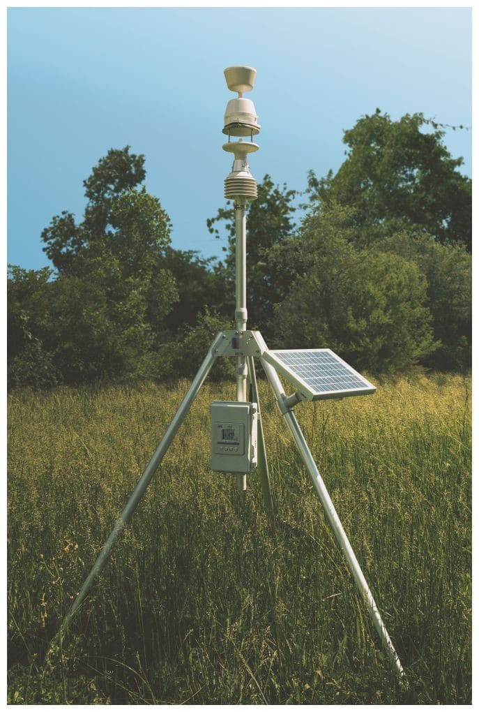
The HDMCS-100 compact weather station measures, at the same point and at the same time, air temperature and relative humidity, wind speed and direction, barometric pressure and rainfall, according to its datasheet. This is the kind of series of your own that a satellite product does not replace: taken on site, with the logging time under your control. The set includes a tripod, solar panel, backup battery and a logger with GSM communication; what remains to be decided is where it goes, what ground cover surrounds the point and where the data are sent, your own FTP server or the manufacturer's cloud.
View datasheet · Talk to a specialist
References
- European Commission, 2026. Successful Launch of EU Copernicus Sentinel-3C to Monitor Our Changing Planet. Published 15 September 2026. Link. Accessed 16 September 2026.
- EU Space Support Office, 2026. OBSERVER: New satellite to carry the Copernicus Sentinel-3 record into the next decade. Published 27 August 2026. Link. Accessed 16 September 2026.
- Woollard, D.; Gauci, A.; Micallef, A., 2026. Multi-Sensor Assessment of the Consistency Between Satellite Land Surface Temperature and In Situ Near-Surface Air Temperature over Malta. Sci, 8(4), 80. DOI 10.3390/sci8040080. Link. Accessed 16 September 2026.
Instruments for this application
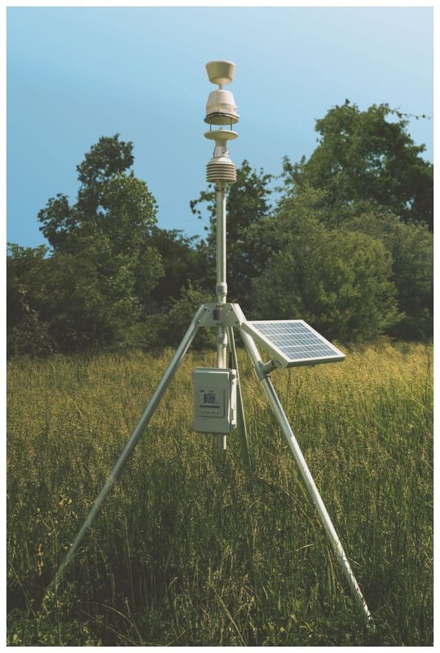
DeltaOhm - GHM Group · HDMCS-100
HDMCS-100 – All-in-One Meteo Compact Station
A ready to use and easy to set up Automatic Weather Station. The HDMCS-100 measures wind speed, wind direction, humidity, dew point, temperature, barometric pressure and rainfall.
Keep reading
Week in review, 14 to 18 September 2026: your own point, the satellite and the laboratory curve
Three articles on what makes a number measured at one point trustworthy, three European signals from the week with their sources, and what is due in the coming days.
Why two identical sensors do not read the same: choosing a radiation shield
The shield around the sensor can contribute more error than the sensor itself. What two peer-reviewed studies say about natural ventilation and forced aspiration, and what to document so the series is usable.
Summer 2026 was western Europe's warmest on record: what changes at your measurement point
Copernicus issued its August assessment statement on 10 September 2026: a record summer in western Europe, with anomalies referenced to 1991 to 2020. What those figures say, and do not say, about a series of your own.